Do you want to know where you will be stuck during the Olympics?
- Published on 19/03/2024 14:58
- Modified on 25/09/2025 19:44
Forgive this little irony, but we cannot escape the collective anxiety just days before the start of the Paris Olympics. So we might as well be ready!
The ministry in charge of Transport has unveiled the highly anticipated interactive map of the Paris 2024 Olympics, detailing the impacts on roads and public transport. This tool will be quite valuable during this summer like no other. It should help anticipate travel in advance, during, and after the Olympic and Paralympic Games of Paris 2024.
From July 26 to September 8, significant impacts due to the Olympics are expected in the Île-de-France region. To help residents better anticipate their daily journeys, this tool lists traffic restrictions and expected crowds in public transport. It is accessible on the website anticiperlesjeux.gouv.fr, amid more or less useful tips and tutorials…
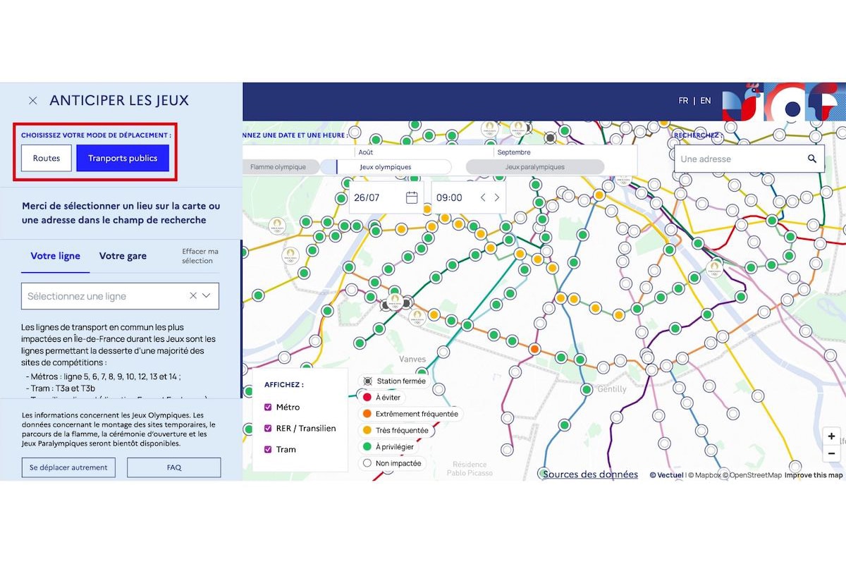
The interactive map of impacts on mobility in Île-de-France
Several modes are available depending on your mode of transport for the day: Public transport mode and Road mode. The map allows you to visualize, hour by hour, the expected impacts on travel in a specific area, road, metro station, or train station in Île-de-France during the Games. Unfortunately, it is not a route calculator, and the map does not offer an alternative route to connect point A to point B.
We won’t hide from you that all of this is still quite messy to use, but an online tutorial should clarify things for you. We’ll see in the first few days if it proves to be genuinely useful, but it is highly likely that the RATP site and community driving assistance apps like Waze and Coyote remain the best ways to travel (almost) peacefully during the Olympics.
This page is translated from the original post "Voulez-vous savoir où vous allez être coincés pendant les JO ?" in French.
We also suggestthese articles:
Also read